Aerial Image Georeferencing
We are excited to introduce a new product from Picarta! Our innovative technology
accurately
georeferences aerial imagery captured by aircraft, drones, and satellites. Even when
the
vehicles
themselves have GPS data, it remains challenging to geolocate images captured by
cameras
on these
moving platforms. Our advanced solution not only localizes the images but also
identifies
the precise GPS coordinates of objects within the images with accuracy down to
meters.
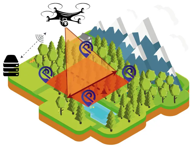
Our technology is ideal for industries like agriculture, urban planning, and
disaster
management.
It provides precise GPS localization of objects in aerial imagery, enabling accurate
mapping,
land use monitoring, and environmental assessments, even from moving platforms like
drones and aircraft.
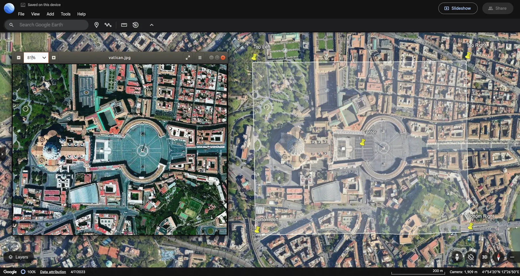
Our model takes as input an aerial image, and if available, the camera altitude and
a
reference GPS
location of the platform (such as a drone or aircraft).
The model then returns the GPS coordinates of the four corners and the center of the
image, as shown in the figure below
To use our Picarta Aerial Imagery service, you can upload an aerial image to our website. Our AI will then analyze the image to determine whether it is suitable for georeferencing.
On the website, you can choose between two options: Georeference or Geolocalize.
- If you do not have a reference GPS location (i.e., you don’t know where the aerial image was taken), use the Geolocalize button.
- If you do have a reference GPS location, press the Georeference button to obtain the exact GPS coordinates for the four corners and the center of the image.
To use Georeferencing through our API, please refer to our GitHub repository:
We’d love to hear from you and answer any questions you may have. Join our Discord community for the latest updates, discussions, and support directly from the Picarta team!